Last updated on 8 December, 2022
The Tarkine Drive – a self guided tour of Tarkine forest, rugged coastline and sacred indigenous sites – is a must do in Tasmania. Our two day itinerary of the Dog Friendly Tarkine Drive gives you time to truly enjoy all the sites and make some unforgettable memories of your time in Tasmania.
The Tarkine Loop has lots of things to do with your dog. A scenic drive, the Tarkine Drive on the northwest corner of Tasmania showcases some of Tasmania’s most diverse and remote wilderness. Best of all, your dog can see and do nearly all of it with you. Even the Arthur-Pieman Conversation Area is dog friendly.
Visiting the Tarkine with our dog Chika was a highlight during our time in Tasmania. For anyone visiting Tasmania with their dog, we highly recommend visiting the Tarkine. The Tarkine is super dog friendly, beautiful and so vastly different the east coast of Tasmania.
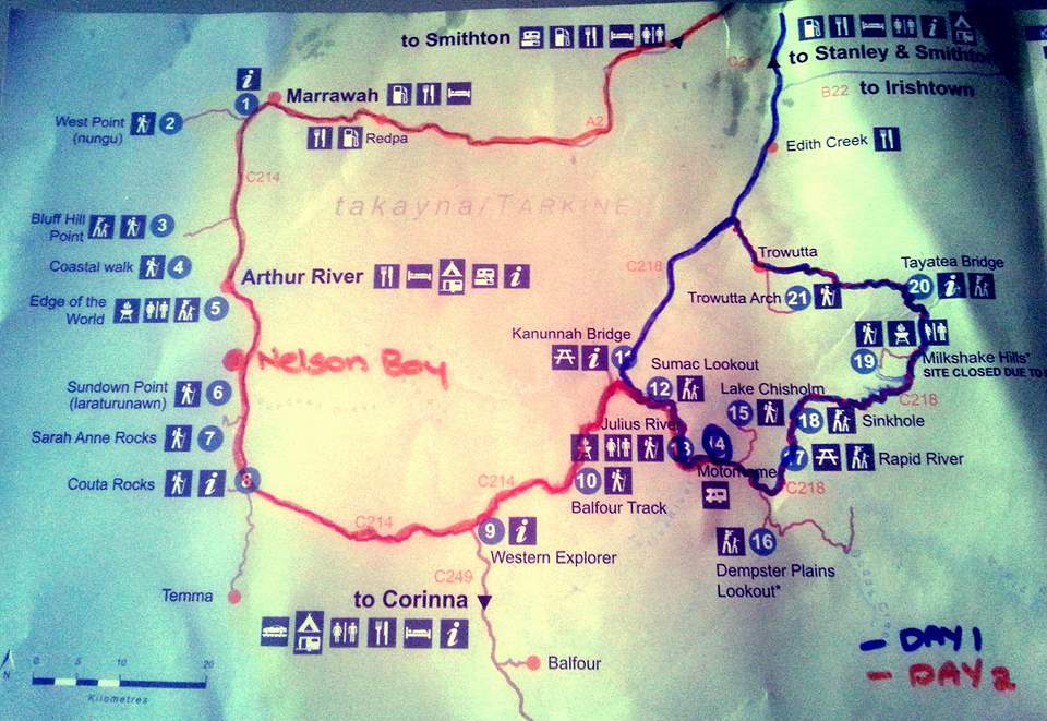
The Tarkine Drive | An Overview
What Is The Tarkine?
The indigenous name for the Tarkine is takayna and it is the traditional land of the Tarkiner People. The area has many sites of cultural significance and remains hugely important to the first people of this land.
Located between the Arthur River in the north, the Pieman River in the south, the coast to the west and the Murchison Highway to the east, the Tarkine has the largest area of Tarkine forest in Australia and second largest in the world. It is a diverse wildness made up of large areas of undisturbed cool temperate rainforest as well as wet eucalyptus forest, sand dunes, mountains, rivers, remote beaches and waterfalls.
It is habitat to native animals such as the Tasmanian Devil, spotted-tailed and eastern quoll, platypus, echidna, wombat, pademelon, bandicoot and brush-tail possum. There are many bird species including the endangered orange-bellied parrot, the wedge-tailed eagle, blue-winged parrot, yellow-tail black cockatoo and many more. It is a popular area for bird watchers.
Some interesting facts about the Tarkine
- In the wet eucalyptus forest trees grow to over 40 metres high
- Tasmania’s two biggest gold nuggets were found in the Tarkine region
- Fossils up to 700 million years old have been found in the Tarkine
Where is the Tarkine Drive in Tasmania?
The Tarkine Drive is on the northwest corner of Tasmania. It is about a 60 kilometre drive from the dog friendly Stanley Tasmania or less than 30 kilometres from Smithton.
Is the Tarkine Drive Sealed?
The Tarkine Drive is a sealed road.
The Arthur-Pieman Conservation Area
Part of the Tarkine area, on the west coast, stretching along rugged coastline from Arthur River in the north to the Pieman River in the south, and the Frankland and Donaldson Rivers to the east, the Arthur-Pieman Conservation Area covers over 100000 hectares.
The west coast is a rugged untamed area of coast line with wild seas, coastal rocks and beautiful beaches. Managed by National Parks Wildlife Services (NPSW) there is no free camping.
The area is also well used (permit needed) by 4WD vehicles, motorbikes and ATVs with numerous tracks and beaches with access for these vehicles.
2 Day Dog Friendly Tarkine Drive Itinerary
This itinerary based on driving to the Tarkine Drive from Stanley or Smithton starts at the Kanunnah Bridge (stop # 11 on the Tarkine Drive Map) and on Day One completes the C218 loop road.
The C218 is not an ideal road for towing because it windy, narrow, with many hills, some potholes and dirt side roads. Also many of the stops have limited area for park or turning a long vehicle. For these reasons we recommend if you are towing to start at the Kanunnah Bridge end of the loop road and from there it is a 10 kilometre drive to the Julius RV Motorhome and Caravan Campground where you can unhitch before heading off on the C218 loop road.
Tips Before Driving The Tarkine
Our Travel Guides are about budget travel and making travel as affordable as possible. The Tarkine Drive is an excellent place to visit on budget as attractions are free to visit. Our tips for reducing or keeping a limit on other costs are:
- Buy food at the supermarket in Smithton if like us you save money by preparing your own meals. There are no supermarkets in the Tarkine area.
- Fill up with petrol in Smithton. Fuel is only available at Redpa. Not only are prices higher it is out of the way.
Day One
We recommend allowing 6 – 7 hours for Day One – 3 – 4 hours for walking and exploring, 1 hour for lunch and 2 hours for driving. The driving a number of small trips throughout the day so it doesn’t feel as though you are in the car too much. Also it is important to note that the roads on Day One are windy, steep in parts, sections have potholes and the road to the Trowutta Arch is gravel. The two hours of driving allows for all these road conditions so take it easy and enjoy the breathtaking scenery.
Kanunnah Bridge and Picnic Area #11 🐾
Kanunnah Bridge is narrow bridge 60 metres above sea level with views of the Arthur River. We chose not to stop here but if you do be on the lookout for trucks and other traffic when walking on the bridge.
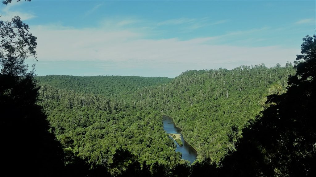
Sumac Lookout #12 🐾
Sumac Lookout is at the end of one minute walking track and with views of the the Arthur River down in the valley.
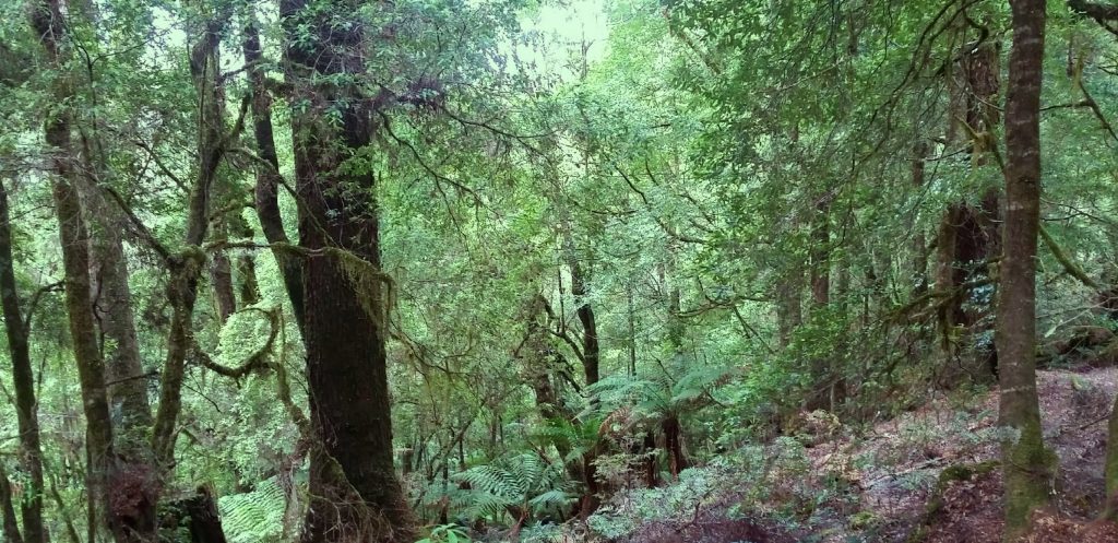
Julius River #13 🐾
There are two walks here both which are easy and worth doing. The Julius River Rainforest walk is less than 30 mins return and the Sink Hole walk took us 45 mins at a very easy pace. Camping is permitted here with plenty of room for tents but very limited space for campers, caravans or motor homes. The RV campground 600 metres up the road.
There are also free BBQs, tables and chairs and toilets at this stop.
Julius RV Motorhome and Caravan Campground #14 🐾
Our recommendation is if you are towing a caravan that you stop here and unhitch before continuing the rest of the Day One Itinerary. At the end of the day return here to camp for the night or pick up your caravan continue your drive by returning to the Kanunnah Bridge intersection.
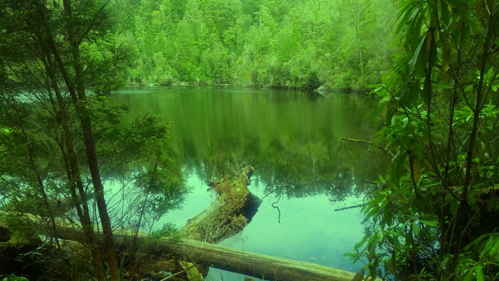
Lake Chisholm #15 🐾
Lake Chisholm is a 30 minute return to walk. Lake Chisholm is a large lake formed from a sink hole. The lake and forest surrounding it is very peaceful. Kayaking is encouraged for those interested. It was difficult to find anywhere to get in easily for a swim as the edges have lots of branches and debris and bottom is very muddy but for those that are keen it is not impossible.
Dempster Plains Lookout #16 🐾
The lookout is at the end of a 10 minute walk. The road to the start of the lookout walk has potholes so.drive carefully.
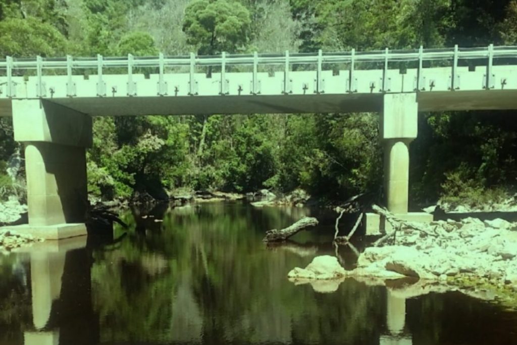
Rapid River #17 🐾
This stop along the Rapid River is by a bridge and it is a brief walk to the waters edge. There are rocks to venture over the along the river’s edge. It is a nice spot to explore.
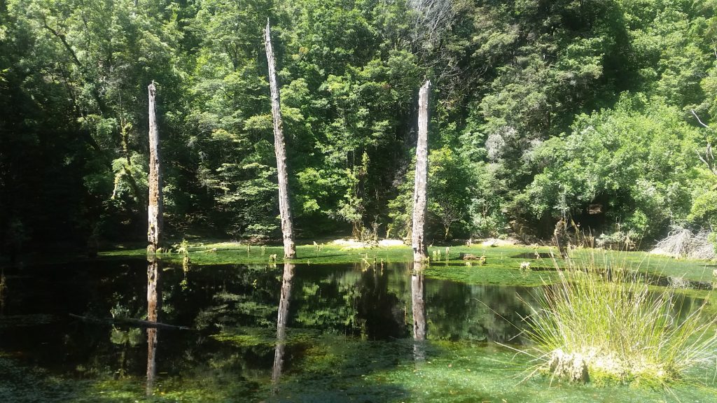
Sink Hole #18 🐾
This is a brief stop right on the side of the road. It is possible to walk along the front of the sink hole and feel yourself sink in the mossy ground which is kind of amusing.
Milkshake Hills Regional Reserve #19 🐾
A bushfire in 2016 caused significant damage to the Milkshake Hills making the track unsafe. The track was closed for nearly two years while Tasmania Parks and Wildlife did repairs and track clearing. The reserve reopened in 2018 although there is still evidence of the bushfire.
There are two walking tracks in the Milkshake Hills Regional Reserve. The Milkshake Hills Rainforest Walk is a short 15 minute loop track through temperate rainforest. The Milkshake Hills Summit Walk is a 1 hour return walk. The reward for walking to the summit is 360 degree views.
Tayatea Bridge #20 🐾
The Tayatea Bridge crosses over the Arthur River. Stop here to view the river.
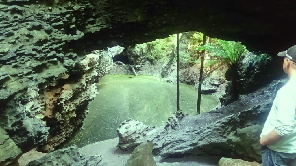
Trowutta Arch #22
Trowutta Arch is a naturally formed rock archway. There are also caves, sink holes and waterholes. This was our favourite stop along the Tarkine Drive. To reach the arch it is an easy 30 minute return walk. There is a waterhole at the arch and a second waterhole is reached with a little effort if you go up and around to the right. If you are adventurous it is possible to climb the rock walls of the arch and around it. The surrounding forest is lovely to walk through as well.
Dogs: The arch is in a national park so no dogs (or pets) are allowed. This is clearly signposted. Chika remained in the car and slept.
Camping End of Day One
We recommend camping at the Julius RV Motorhome and Caravan Campground #14. It is quiet, free and if you are lucky you may see a spotted quoll like we did.
Day Two
Day two starts by returning to the Kanunnah Bridge intersection (with your caravan in tow) and turning left on to the C214 towards Arthur River and Arthur-Pieman Conservation Area on the west coast.
For Day Two we recommend allowing about 4 – 8 hours including driving, walking and exploring. The variation depends on how many of the walking trails you chose to do.
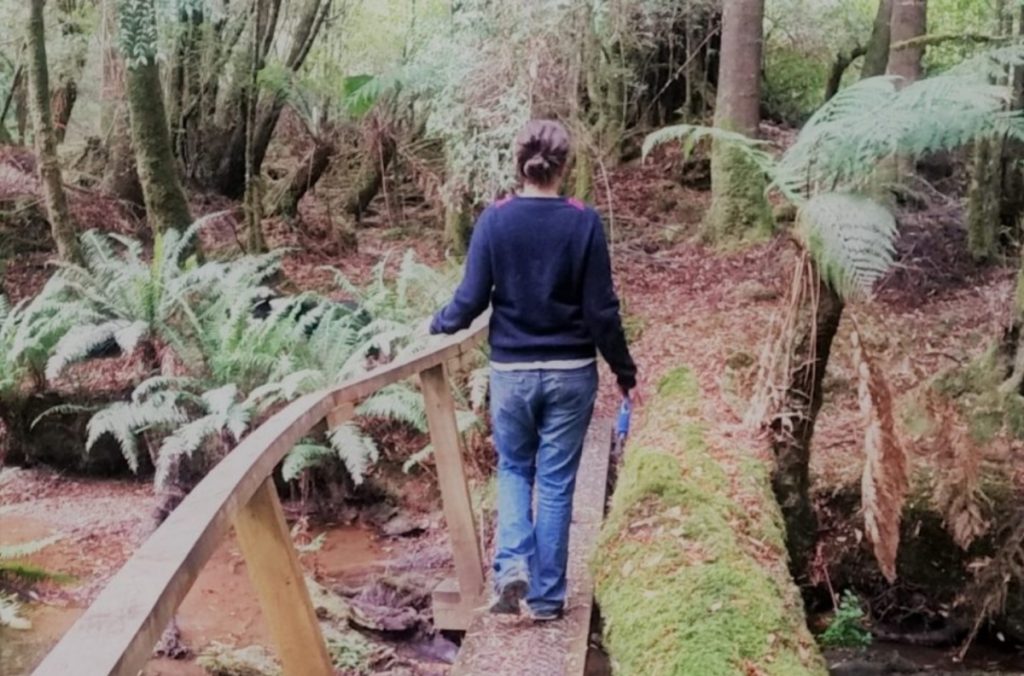
Balfour Track #10 🐾
The Balfour Track is a three hour return walk. We did about an hour. What is quickly apparent about this track in that you really are down in amongst the tall trees, fallen logs, tree ferns and mosses. It is fairy tale like – enchanting and beautiful. We very much enjoyed the track that we walked.
Western Explorer #9 🐾
This is considered the entry point to the Tarkine Drive when coming from Corinna.
Couta Rocks #8 🐾
Couta Rocks is a small village that reminded us of isolated Inuit settlements we have seen in documentaries. Stop here, explore the village and walk down to the water’s edge to see some interesting rocks. Poor weather in the day we visited had us return to our car shortly after arriving.

Sundown Point State Reserve (laraturunawn) #6
A 2 kilometre return walk to Sundown Creek and ancient Aboriginal rock carvings. Dogs are not permitted.
This is also where Nelson Bay Campground is located and was our choice for our campsite. Dogs are permitted at the campground.
The Edge of the World #5 🐾
The Edge of the World or Gairdner Point as it is also called, is at the end of a short drive along a gravel road. It is known as The Edge of the World because between it and all the way to Argentina is the longest expanse of uninterrupted ocean in the world. It is also where the Arthur River meets the sea and the junction is fascinating to watch.

Coastal Walk #4 🐾
4 kilometre return walk along the coast to Church Rock. The track, shared with 4WD starts on the north side of the Arthur River.
Bluff Point #3 🐾
This another short drive along another gravel road to the coast line. Here is an unmanned lighthouse and a few trails down to the beach to wander if you so chose.
West Point State Reserve #2
This is an area with Aboriginal significance. It is also popular for surfing.
This is another area dogs are not permitted.
Marrawah #1 🐾
Marrawah is a village just outside the upper region of the Pieman-Arthur Conservation Area. It is has a general store where fuel is also available. It is important to note that availability of fuel on the west coast is limited so be mindful of this when planning your trip. Marrawah also has a pub “the best in the west.”

Camping End of Day Two
There are a number of campgrounds to choose from at the end Day Two. We suggest clicking here to find out more.
We camped at Nelson Bay for two nights for $6 per night for two people. It is an isolated coastal spot in the Pieman-Arthur Conservation Area. It is very much exposed to the strong coastal winds unless you can get in close to a grass covered dune between the bay and the camping area. I really enjoyed watching the wild seas and waves crashing on the rocks. There are no facilities at all. Dogs permitted on a leash.
Optional Day Three
The Arthur-Pieman Conservation Area is an area popular for four wheel driving, fishing, boating, visiting the beaches and exploring the river. You may wish to stay an extra day or more to continue enjoying and exploring what the area has to offer. It is well worth your time to do so.
We hope you have found this 2 Day Itinerary of the dog friendly Tarkine Drive useful. Happy travels and drive safely.


