Last updated on 8 December, 2022
Rich with history and the incredible natural beauty of the Argylla Ranges, the Ballara Mining Heritage Trail is a must do as you travel on the Overlander’s Way between Mount Isa and Cloncurry. The 23 kilometre trail showcases the local early 1900s mining history and the picturesque Fountain Springs, a waterhole and oasis perfect for swimming and a picnic.
It was purely by chance we met Mark Van Ryt the secretary of Mount Isa Landcare Group on our way to do the trail. Mark also on his way to the trail with some members of his family kindly invited Daryl and I to join them.
Over the next few hours Mark graciously told us about the terrific work Mount Isa Landcare have done and are continuing to do to preserve the history of mining communities of the past. He also shared the stories of the people that worked in the mines and lived in the mining towns. It was a fascinating and informative day!
Same as the gorgeous Copperfield Gorge, the Ballara Mining Heritage Trail and all its sites including Fountain Springs is dog friendly.
Where Is It Ballara Mining Heritage Trail
The start of the trail is on the south side of the Overlanders Way (Barkly Highway) midway between Cloncurry and Mount Isa (about 60 kilometres from each town). Look for the Fountain Springs Rest Area and the trail entrance 200 metres from the rest area, back towards Cloncurry on the opposite side of the road. It is signposted.
Trail Conditions
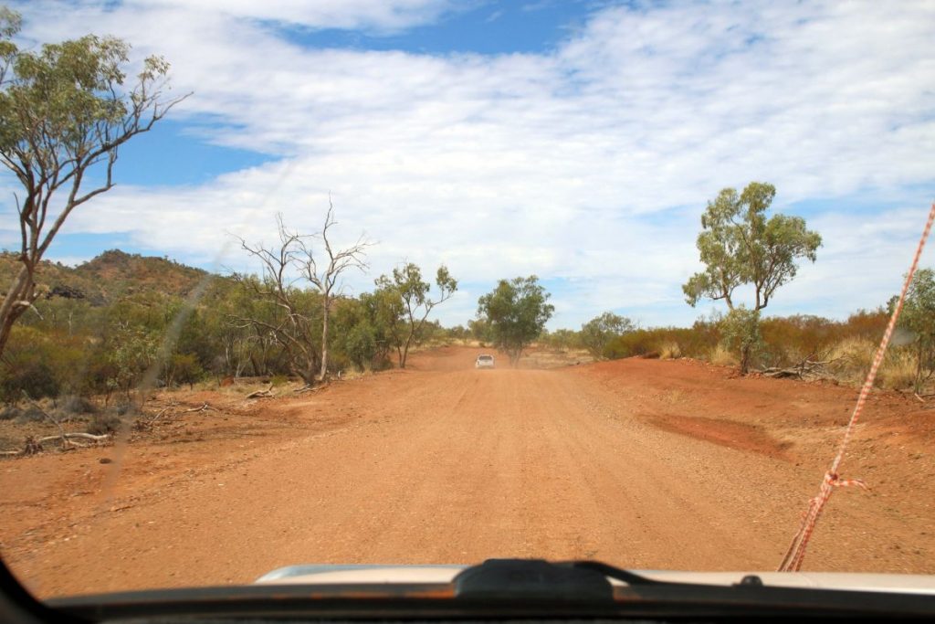
Currently there is a sign at the beginning of the track with the distances to each of the sites along the way, this is accurate. It also states the track is four wheel drive only. This is no longer strictly true.

Historically the Ballara Mining Heritage Trail has been a rough 4WD track and it would take 2 hours of careful driving to get to Fountain Springs. Recently, a grant for flood repairs was used to improve the track making it accessible to all vehicles including 2WD. This is still a dirt road and thus conditions can change especially after a weather event such as heavy rainfall. Use your own discretion when deciding whether to drive it in 2WD.
That said the track to Rosebud cemetery and another to Hightville Tunnel are rough especially the latter and require a 4WD.
The Landscape and Natural Beauty
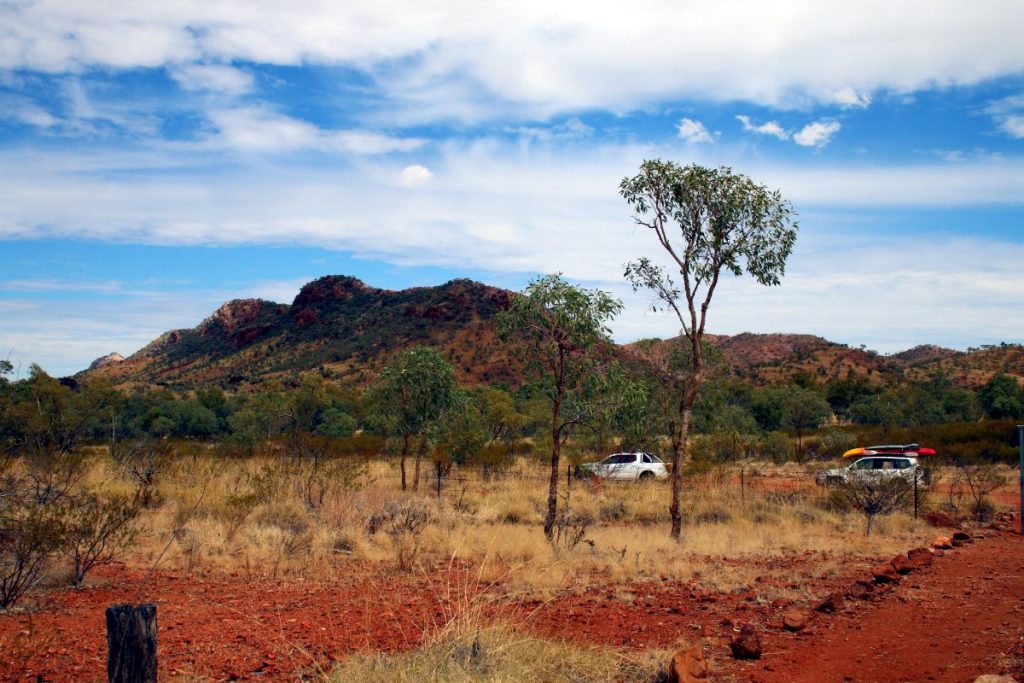
The Argylla Ranges through which the Ballara Mining Heritage Trail travels is a landscape of remarkable natural beauty. The landscape of sparsely wooded mountains, covered in spinifex and other grasses as well as rock formations millions of years in the making, is like nowhere else.
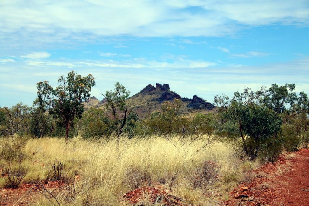
The beauty of the ranges is enhanced by the contrast of the rocky terrain and rich red dirt against the subtle green hues of the trees and grasses which somehow manage to grow here.
It is hot here. The rocky ground, red dirt and little tree coverage means it can get real hot real quick. So be sure to look after yourself. Take plenty of water to drink and don’t spend too long in the sun.
Basic Etiquette on the Trail
These rules really are simple:
* Open a gate. Shut the gate.
* No entry sign. Stay out.
* Take it in with you. Take it back out.
* Drive only on the tracks. You are not a trail blazer.
* Be respectful. Do no damage.
The Historic Sites and Fountain Springs
The Ballara Mining area started in 1905 when copper ore was found. It all ended just 15 years later at the end of WW1 when the price of copper plummeted and it was no longer financially feasible to mine the ore. In those 15 years a number of mines were operational and three towns were established – Bulonga, Ballara and Hightville – with houses, a hotel, shops, a hospital, a post office and schools.
Along the trail are covered information signs and on each sign has a map depicting the layout and features of each town as well as a written summary of its history.

Bulonga
One of the original towns long since gone is now marked with an interpretative sign with information known about its history. Bulonga was built in 1905 but was only inhabited for a few years.
Rosebud Cemetery
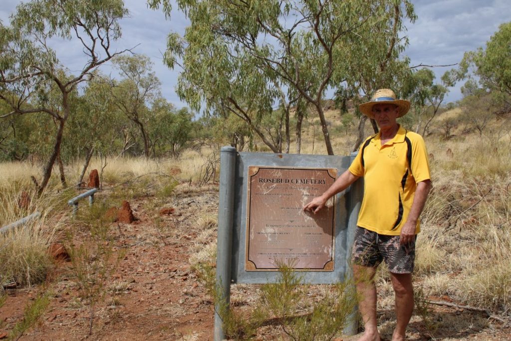
To get to the Rosebud Cemetery there is a short side track unmarked on the left side of the trail after the Bulonga site, look for the tyre tracks. It is then a short drive to the cemetery which is marked by a sign and barriers.
The story goes that the existence of the cemetery, with unmarked graves, was known for a long time but not where. It was the stories passed down through the pastoral owner’s family of graves decorated with sea shells in particular gully that eventually lead to the discovery of the graves after three of dedicated searching.
Today, a sign stating the each of the deceased names, place of birth, aged at death stands at the cemetery in their memory. However, since the sign was made more information has come to light and it is now known that some of the information on the sign is inaccurate. This is true of all the cemetery signs on the trail so plans by Landcare are to have new ones made and installed in the near future.
Rosebud Weir
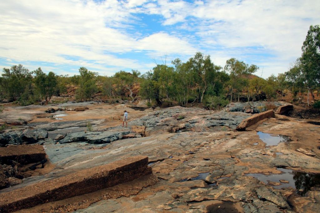
The trail to Rosebud Weir is signposted and is a short diversion from the main trail off to the right.
The weir was built in 1914 to prevent the Corella River flooding the Rosebud Mine after heavy rainfall and to provide Bulonga with a water source. No longer functional due to major damage, the hope is one day it will be restored and used as a functional water source for cattle as well as preserve more of the local history.
A wonderful spot with shade and a grassy area next to the weir, it is a great spot to have a picnic or go for a stroll. It is very likely you will see cattle hanging around. They may be curious but will keep their distance.
Ballara Cemetery
This is the second of three cemeteries along the trail again marked by a sign and barriers.
Old Ballara Town Ruins
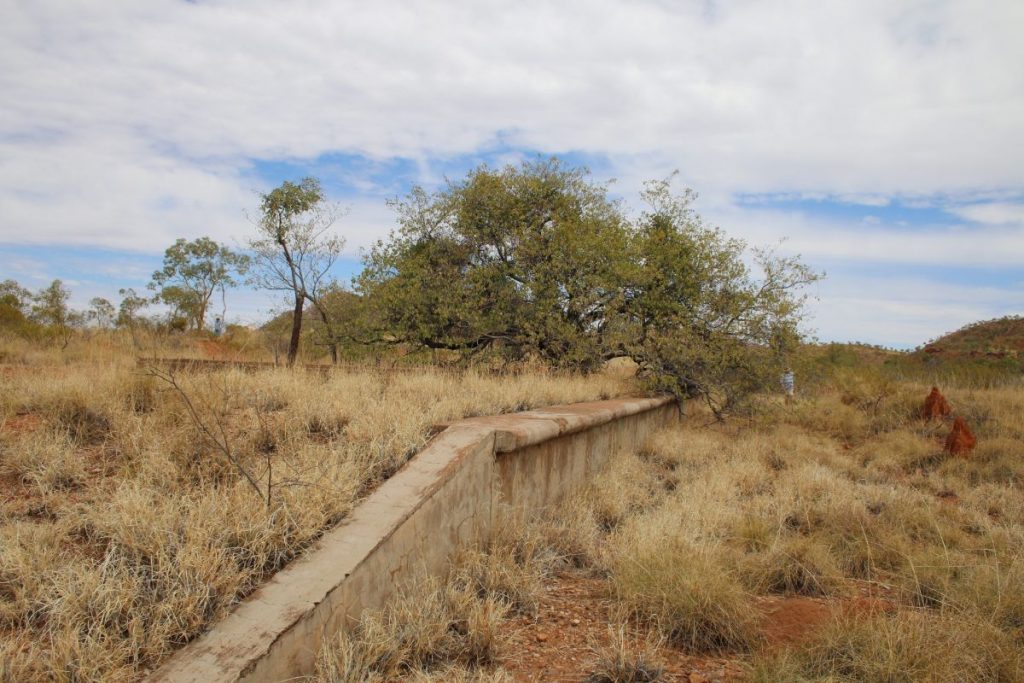
On the roadside marked by a covered information sign is the Ballara Town Ruins. Ballara was built when the rail line needed to transport the copper ore by train could not be built to the Hightville up in the hills.
There are Ballara ruins on both sides of the road. It is clear from the gate, fenced area and a path marked with rocks were you will find the ruins including the foundations of past buildings and a train platform.

Fountain Springs
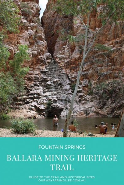
Fountain Springs is awesome. At the end of hot dusty drive checking out the historical sites, the waterhole is a welcome oasis. The only permanent water source in the area Fountain Springs is fed by an underground water table and up through a fault line.
The scenery surrounding the springs is spectacular. A towering rock face of quartzite with a split through its middle (fault line) visible points to the location of the waterhole. On the traditional country of the Kalkadoon people it is a place cultural and spiritual significance dating back tens of thousands of years.
A popular swimming and picnic spot Fountain Springs is also famously featured in the Crocodile Dundee movie scene where the character Sue Charlton played by Linda Kozlowski’s is nearly grabbed by a crocodile.
In our opinion this is one of the best waterholes in Queensland! And while you’re there you may want to have a go on the rope swing.
It is worth noting that because this is the only permanent source of water, animals and birds rely on it including cattle. You will hear the cattle coming as their hooves walk over the gravel and rocks. General advice is be quiet around them, let them drink and they will leave soon enough. Don’t go trying to scare them away.
Hightville Tunnel Track
The Hightville Tunnel Track off the Ballara Mining Heritage Trail takes you past the old Ore Transfer Stage, to the Hightville Cemetery and to the heritage listed MacGregor Mine Rail, Rail Tunnel (the official name of the Hightville Tunnel). This track is only suitable for 4WD vehicles.
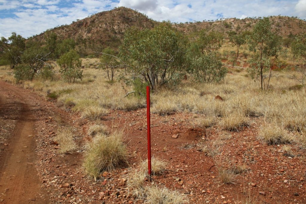
From the cemetery to the tunnel there are red painted pickets to follow. It is 900 metres of very rough track and at one short section where your vehicle will lean to one side about 20 degrees. We did it without any issues is our un-lifted Prado. Some people chose to walk the track from the cemetery and there is a cleared area to the side where you can park safely.

Ore Transfer Stage
The Ore Transfer Stage looks somewhat like a train platform only significantly higher. This was where ore was transferred or loaded into open top containers or tubs on freight trains to be transported.
The stage is still in good repair given its age.
Hightville Cemetery
Ballara Mining Heritage Trail is about the mining history of the region and it is also about the people that lived and worked in the mines and the towns. People came from Ireland, New York, Afghanistan and all over the world to this remote place in Savannah Gulf in far north Queensland. Makes you wonder how they even heard of such a place!
One such person was a man named Thomas Tame. Thomas worked in the mines and was a fiddle player known to entertain guests and customers at the Hightville Hotel. Sadly Thomas died on 15 February 1912 in a mine explosion. His body was brought out of the mine by his work mates. They then spent a day digging Thomas a grave in the hard rocky ground under a blazing hot sun and collected £90 to buy a marble headstone. This was all so their fallen comrade could laid to rest with dignity.
As it goes some times, his family were unaware of his whereabouts and had assumed he had abandoned them, returning overseas. This continued to be what his ancestors believed for generations. That is until Landcare research in to the area, its history and residents came across an interview where one of the men told the story of Thomas’s death and burial. Landcare were also able to find Thomas’s grave, track down his descendants and tell them the truth about Thomas.
Unfortunately and very disappointingly the marble headstone was stolen. This means part of Thomas’s and his work mates legacy is missing, possibly gone forever. In its place, donated by a local priest, is a cross from the old Mary Kathleen Church. If you have or know the whereabouts of the marble headstone I know that its return would be greatly appreciated.
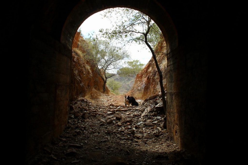
Wee MacGregor Rail Tunnel aka Hightville Tunnel
About 50 metres before the tunnel entrance is an information sign and this is the place to park your car if you have driven the track. The tunnel is 77 metres long and cut through MacGregor Hill. You can walk through the tunnel and enjoy views out the far side.
You may encounter Fairy Bats in the tunnel. As their name suggests they are only small and very flighty so sightings are often only brief. For the best chance of seeing the bats take a torch or allow a few moments for your eyes to adjust.
Camping Near the Trail
There is no official camping on or along the trail itself however it is generally accepted. The most popular spots are the Rosebud Weir and Fountain Springs. If you do camp, please be respectful of where you are and if asked to move on do so.
There are official campgrounds near to the trail. All mentioned below are free camping and have no power. For caravan parks and powered sites there are options in Mount Isa and Cloncurry.
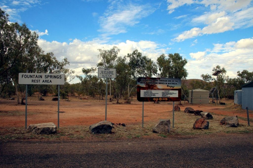
Fountain Springs Rest Area
Fountain Springs Rest Area on the Barkly Highway exactly midway between Mount Isa and Cloncurry. The actual camping area is well off the road and this helps to reduce the road noise.
This rest area only allows camping for one night. It is also only 200 metres from the start of the trail. Here you will also see an information board with a mud map of the trail.
General Information:
⏲️ 20 hour limit
🆓 Free
❎ No power sites
🐕 Dog friendly
🚻 Flushing toilets (no lights)
✅ Suitable all size rigs
🍽️ Picnic tables
🌳 Shade
🚮 Bins
📱 Telstra reception
🚱 No drinking water
Address: Barkly Highway – 60 km east of Mount Isa and 60 km west of Cloncurry
Corella Creek | Clem Walton Park
Clem Walton Park is well signposted on the Barkly Highway; turn off the highway where you see the sign.
To reach the Corella Creek camping area drive through the first gate (the gate is likely to look locked but it is not), drive until you come to second gate with a sign “Timberu Station”. Go through the gate and drive another 1.5 kilometre drive along the gravel road to the Corella Creek. Note, the road is uneven in some spots but everything from coaches to caravans to mini vans use the road without any difficulty.
Campsites are waterfront along the creek making activities such as swimming, kayaking and fishing possible to do right from your site. Birdlife is also abundant here and the scenery along the creek is beautiful.
There are decent number of sites along Corella Creek however it can be very busy during the dry season (winter months) when tourism in far north Queensland is at its peak each year. Generally though, with campers coming and going frequently it is usually possible to get a spot. If not, there is the Corella Dam Camping Area (see below).
General Information:
🆓 Free
❎ No power sites
🐕 Dog friendly
🚻 Flushing toilets
✅ Suitable all size rigs
🌿 Nice Scenery
🏊 Swimming
🍽️ Picnic tables
🌳 Shade
🚮 Bins
❎ No phone reception
⚡ Generators allowed
🚱 No drinking water
🔥 Campfires permitted
Address: Barkly Highway – 68 km east of Mount Isa and 52 km west of Cloncurry
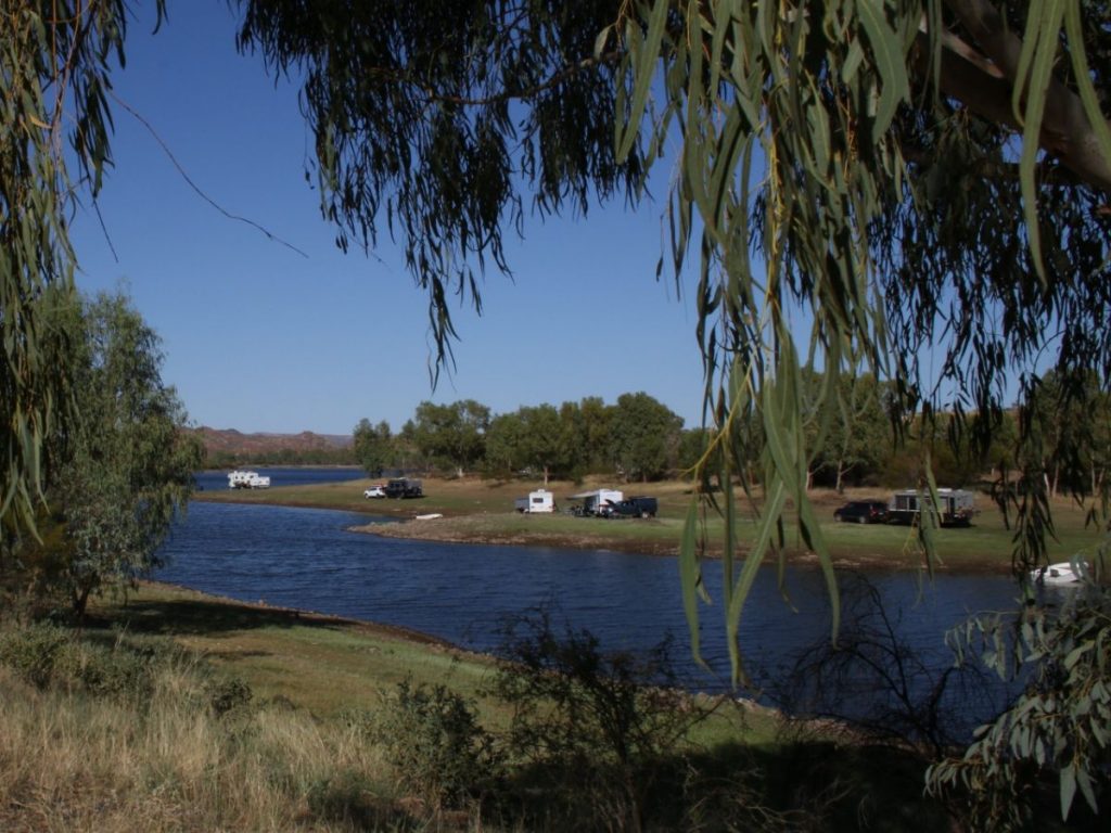
Corella Dam Campground | Clem Walton Park
To get to the Corella Dam Campground look for signs for Clem Walton Park off the Barkly Highway and turn off here. You will immediately see a gate, open the gate and drive through, remembering to shut the gate behind you.
Drive on and follow the gravel road around to the right and not through the second gate. Soon the road will divide into two, with one signposted Clem Walton Rd and the other to the boat ramp. Both roads will take you to camping areas. Further along the Clem Walton Rd you will drive come to a spillway. At the spillway there is a track on the right or alternatively you can drive over the spillway; either will lead to more camping areas.
As you have probably worked out, the Corella Dam Campground is huge. There are some areas that have waterfront camping on the edge of the dam, others are in amongst the trees and some are more elevated with a view over the dam. Take the time to look around and find your perfect spot.
Corella Dam and the surrounding landscape is wonderful. Originally we had planned to stay for two nights and ended up staying a week. The dam is great for watching bird life as well as swimming, boating and fishing as well as watching sunsets. It is also just a great place to chill, have a campfire and meet other campers.
General Information:
🆓 Free
❎ No power sites
🐕 Dog friendly
❎ No toilets
✅ Suitable all size rigs
🌿 Nice Scenery
🏊 Swimming
🚣♀️ Boat ramp
🌳 Shade
🚮 Bins
📱 Minimum Telstra reception
⚡ Generators allowed
🚱 No drinking water
🔥 Campfires permitted
Address: Barkly Highway – 68 km east of Mount Isa and 52 km west of Cloncurry
Mary Kathleen Town Campground
Mary Kathleen was the town built to house and provide services for the workers at Mary Kathleen Uranium Mine (now a tourist site). The town operated for two periods between 1956 – 1982. Today, all that remains are the streets of Mary Kathleen and the foundations of many of the buildings and houses that once stood in the town.
The entire area is now a free camp. It is a very large area with plenty of space to spread out. If you camp here be sure to check out the remaining features and information about the town.
General Information:
🆓 Free
❎ No power sites
🐕 Dog friendly
❎ No toilets
✅ Suitable all size rigs
🌿 Nice scenery
🌳 Shade
🚮 Bins
📱 Telstra reception
⚡ Generators allowed
🚱 No drinking water
🔥 Campfires permitted
Address: Barkly Highway – 57 km east of Mount Isa and 63 km west of Cloncurry
We have fallen in love with the landscape here, the history and the stories of the people both past and present. Hopefully you enjoy the Ballara Mining Heritage Trail and the Argylla Ranges as much as we did.
PIN It!
Recent Posts
- The Best Dog Friendly Road Trips Australia
- Buying a Caravan for the First Time. What Features and Fittings are Best?
- 4 Best Options for Tethering Your Dog When Camping
- Kitting Out Your Caravan and Car for an Incredible Trip Around Australia
- 14 Stunning Blue Mountains Dog Friendly Camping Spots


